When the India Meteorological Department issued a red alert for Chhattisgarh on October 27, 2025, it wasn’t just another weather warning — it was a countdown to disaster for the already vulnerable forests and villages of the Bastar Division. Cyclonic Storm Montha, intensifying over the Westcentral Bay of Bengal, was no longer a distant threat. By late afternoon, the IMD confirmed extremely heavy rainfall was imminent, with isolated pockets in south Chhattisgarh already soaked by 10 cm of rain in just 24 hours. The storm, forecast to make landfall along the Andhra coast on October 28, would then veer northward — dragging monsoon chaos into the heart of central India.
Storm’s Path: From Coast to Highlands
The IMD’s National Bulletin No. 31 painted a chilling picture: very heavy rainfall of 12–20 cm expected at isolated locations in Chhattisgarh on October 29, following heavy downpours in the south on the 27th. What made this unusual wasn’t just the volume — it was the timing. October is typically the tail end of the monsoon season, when rainfall tapers off. But Montha was a late-season anomaly, fueled by unusually warm waters in the Bay of Bengal.Andhra Pradesh’s N Chandrababu Naidu, Chief Minister, held an emergency meeting via the Real Time Governance Society (RTGS) on October 27, confirming the storm’s trajectory. "The system is expected to weaken and move towards Chhattisgarh as a cyclonic storm," he told officials. That’s the scary part — even weakened, a cyclonic storm carries more than wind. It carries water. And in Chhattisgarh’s hilly, forested terrain, water doesn’t just fall — it rushes.
Who’s at Risk? The Forgotten Villages
While coastal cities like Visakhapatnam and Bhubaneswar braced for surges and power outages, the real crisis was unfolding inland. In the Bastar Division, where roads are narrow, bridges are aging, and many villages lack proper drainage, the forecast meant more than inconvenience — it meant displacement. The IMD warned of "localized landslides," "damage to kutcha roads," and "inundation of standing crops." For tribal farmers who rely on millet and pulses, a single day of flooding can wipe out a year’s income."We’ve seen floods before," said a village headman from Kondagaon, speaking anonymously. "But this… this feels different. The rain came fast on the 27th, and the river behind our hill started rising before sunset. We moved our grain to the upper floor. We don’t know if it’ll be enough."
Meanwhile, the National Disaster Response Force (NDRF) deployed 12 teams across Chhattisgarh, Odisha, and Andhra Pradesh. Helicopters were placed on standby in Raipur and Jagdalpur. Relief camps were set up in 47 schools and community halls, each stocked with Rs 3,000 cash, 25 kg of rice, and clean water packets per family — a standard package, but one that could mean survival.
The Ripple Effect: From Bihar to Bengal
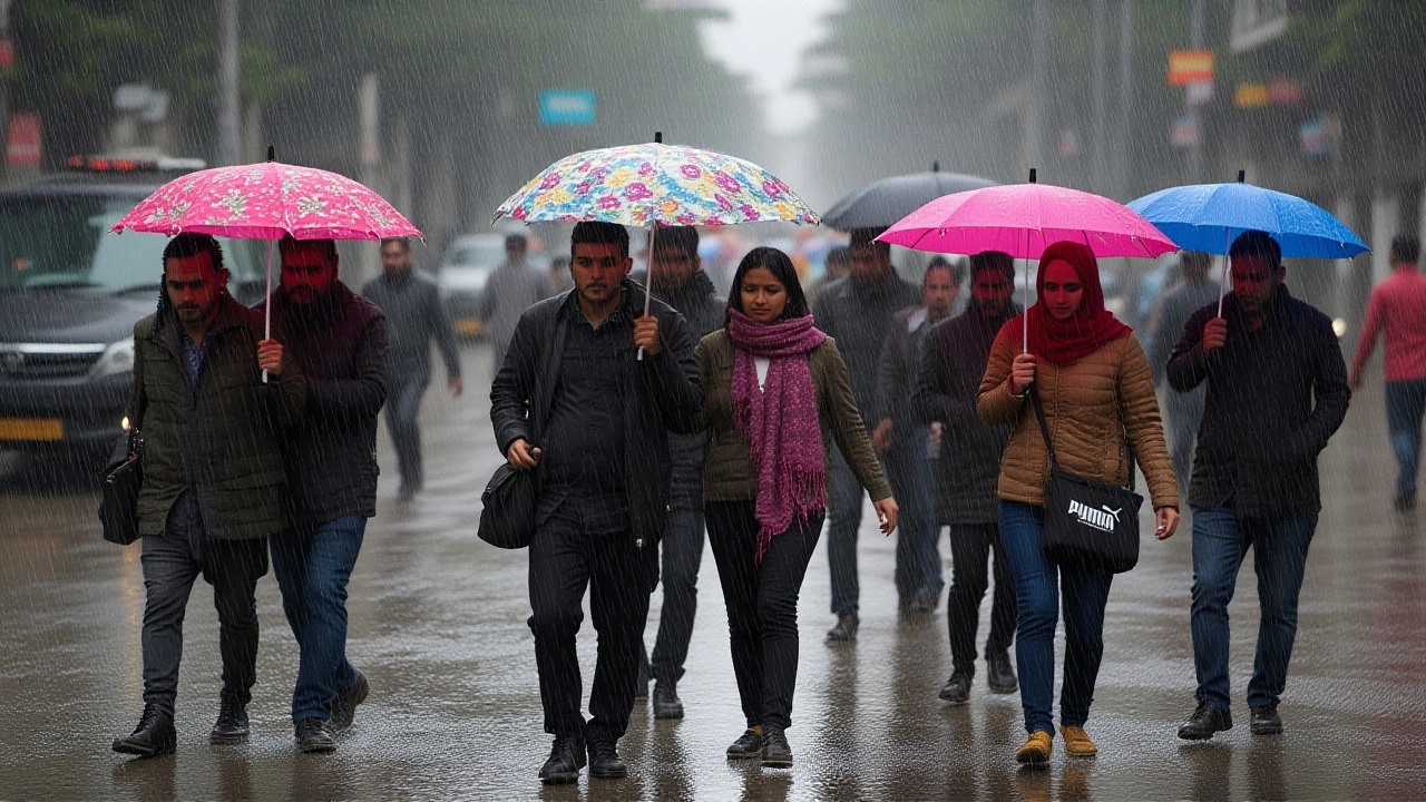
The storm’s shadow stretched far beyond the landfall zone. The Patna Meteorological Department issued a heavy rainfall alert for Bihar on October 28, with districts like Bhagalpur and Munger bracing for 15–20 cm by October 31. In Jharkhand, the Ranchi Meteorological Center warned of continuous rain from October 28 to 31 — a stretch that could trigger riverine flooding along the Damodar and Subarnarekha rivers.Even West Bengal, hundreds of kilometers north, wasn’t spared. South Bengal — including Kolkata and Howrah — was told to expect heavy rain from October 28 onward. The East Coast Railway canceled or diverted over 37 trains, stranding thousands. In some areas, waterlogged platforms turned into lakes. Commuters waited hours under umbrellas, watching the sky darken.
Why This Storm Matters
This isn’t just about rainfall totals. It’s about a pattern. Climate scientists have noted a 37% increase in post-monsoon cyclones over the Bay of Bengal since 2015. IMD Director General Mrityunjay Mohapatra confirmed this trend in a recent interview: "The monsoon is no longer a seasonal rhythm — it’s becoming erratic, violent, and unpredictable."Chhattisgarh, often overlooked in national disaster planning, is now on the front lines. Its forests, rich in biodiversity, are drying out between rains — then suddenly drowning. Its tribal communities, with limited access to early warnings, are paying the highest price.
What’s Next?
The next 72 hours are critical. The Central Water Commission has been asked to monitor river levels in Bihar, Jharkhand, and Chhattisgarh around the clock. The Prime Minister Narendra Modi has promised central assistance, but on the ground, it’s local officials and volunteers who are carrying sandbags, evacuating homes, and checking on elderly residents.By October 30, the storm is expected to dissipate over Madhya Pradesh. But the damage? That lingers. Crops rot. Roads wash away. Families lose everything. And in places like Bastar, where government reach is thin, recovery can take years.
Frequently Asked Questions
How does this affect tribal communities in Bastar?
Tribal villages in Bastar, many accessible only by footpaths or seasonal roads, face disproportionate risk. With limited access to mobile networks and early warnings, residents often learn of the storm too late. Over 60% of homes in the region are kutcha structures, vulnerable to collapse under heavy rain. Relief camps are being set up, but supply chains are strained — many villages won’t receive food or medicine until November.
Why is Chhattisgarh getting heavy rain when the cyclone hits Andhra?
After landfall, Cyclone Montha weakened but retained its moisture-laden core. As it moved northwest, it interacted with a stationary upper-level trough over central India, forcing the rain clouds to stall over Chhattisgarh. This phenomenon, called "orographic enhancement," causes rainfall to intensify over hilly terrain — which is exactly what’s happening in the Eastern Ghats bordering Bastar.
What’s the difference between a cyclonic storm and a severe cyclonic storm?
The IMD classifies cyclones by wind speed. A cyclonic storm has winds of 63–88 km/h, while a severe cyclonic storm reaches 89–117 km/h. Montha was expected to reach the latter category before landfall, making it capable of uprooting trees and damaging concrete buildings. Even after weakening, its residual system carried enough moisture to cause catastrophic rainfall inland.
Why weren’t more people evacuated earlier?
Evacuations are complex in remote areas. Many villages lack transport, and authorities fear panic if warnings are issued too early. The IMD issued alerts 48 hours in advance, but last-mile communication remains weak. In Bastar, only 32% of households received SMS alerts — the rest relied on word-of-mouth or local panchayat announcements, which often came too late.
How does this compare to past cyclones like Fani or Amphan?
Unlike Fani (2019) or Amphan (2020), which hit densely populated coastal zones, Montha’s impact is inland and less visible. Fewer media crews are there, and fewer political visits occur. But in terms of rainfall volume, Montha’s 20 cm in Chhattisgarh rivals Amphan’s peak in West Bengal. The difference? Amphan had 100,000+ people evacuated. Montha’s inland victims may never make national headlines.
What should residents do if they’re under a red alert?
Stay indoors. Avoid low-lying areas and riverbanks. Keep emergency kits ready — flashlight, water, medicines, and important documents. Check local radio or WhatsApp alerts from the IMD and district administration. If your home is on a slope or near a river, move to a designated shelter immediately. Don’t wait for official orders — if the rain is relentless, act.